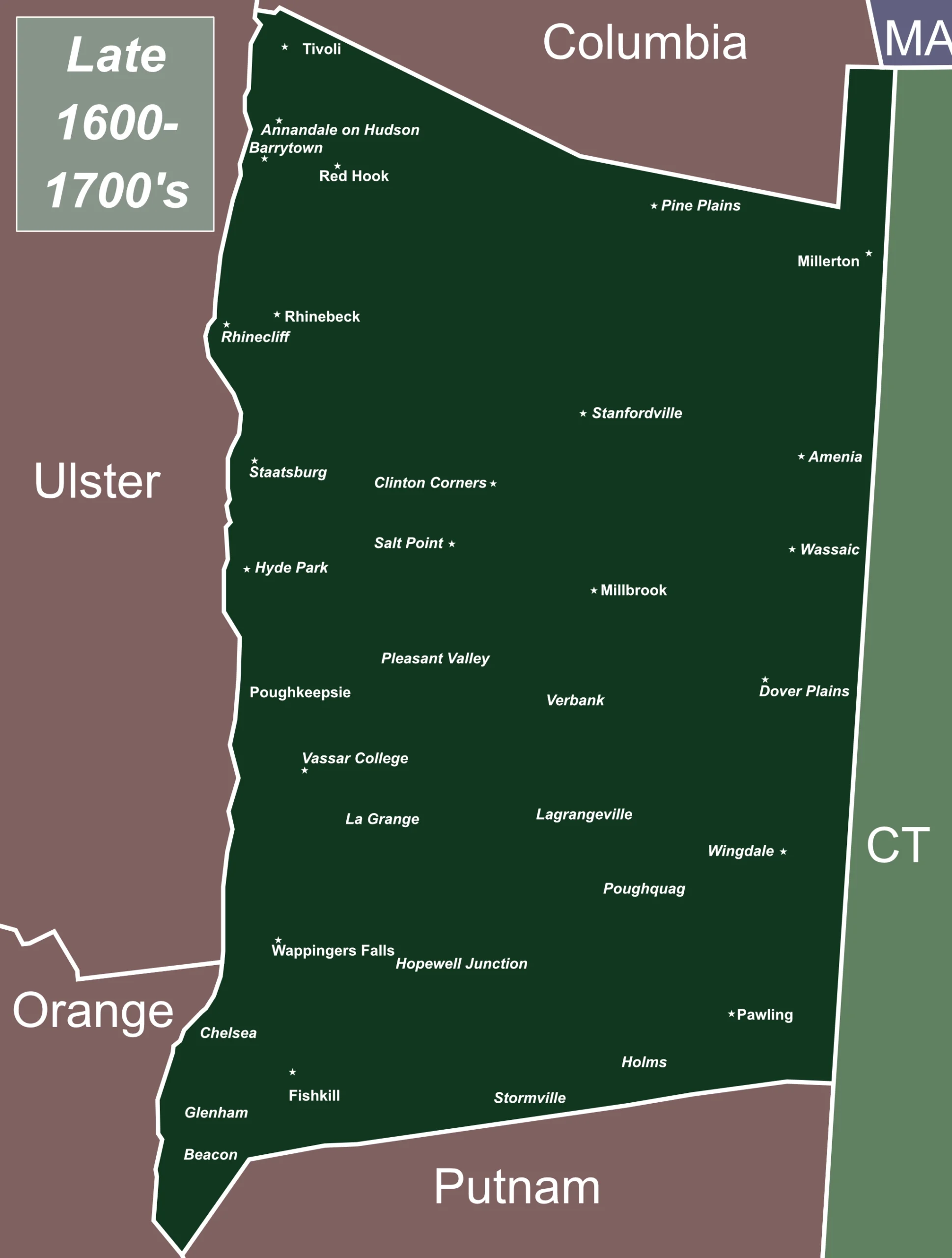
Late 16-1700’s – Dutchess is farmlands with county-level governance. While there was a series of subdivisions (e.g. wards then precincts), towns don’t yet exist. A select few hamlets and villages scattered throughout the county had U.S. Post Offices. (in small type on the map.) Residents instructed family and associates which post office to address their mail since they traveled to retrieve it.
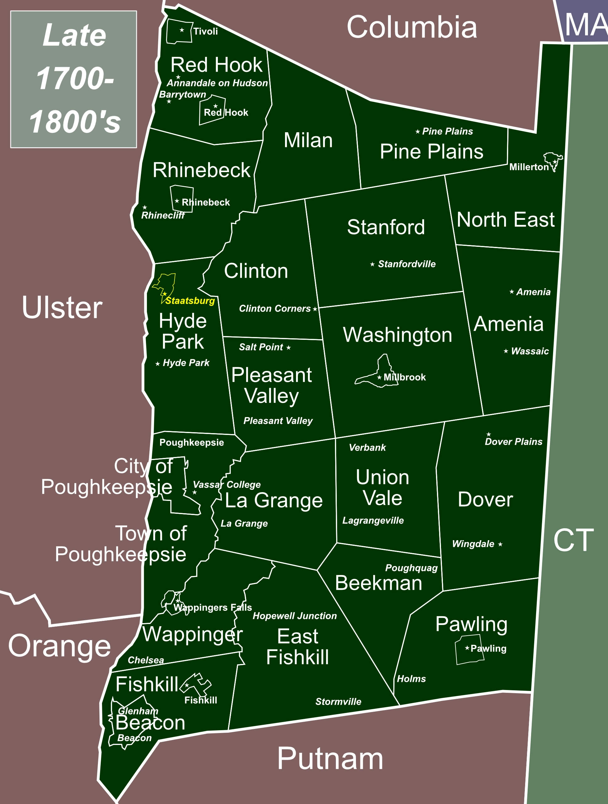
Late 17-1800’s – As a result of the NY state legislature’s 1788 “Act for Dividing the Counties of This State Into Towns”, any county subdivisions were abolished, and counties were instead subdivided into towns and existing cities. Their boundaries outlined in white. (Their names in large type, were often that of their largest hamlet or village.) Some villages within towns also incorporated for an additional layer of governance (e.g. Fishkill, Millbrook, Millerton, Pawling, Red Hook, Rhinebeck, Tivoli). Post office names were still named by the hamlet or village where they were located, unimpacted by the new towns and their names.
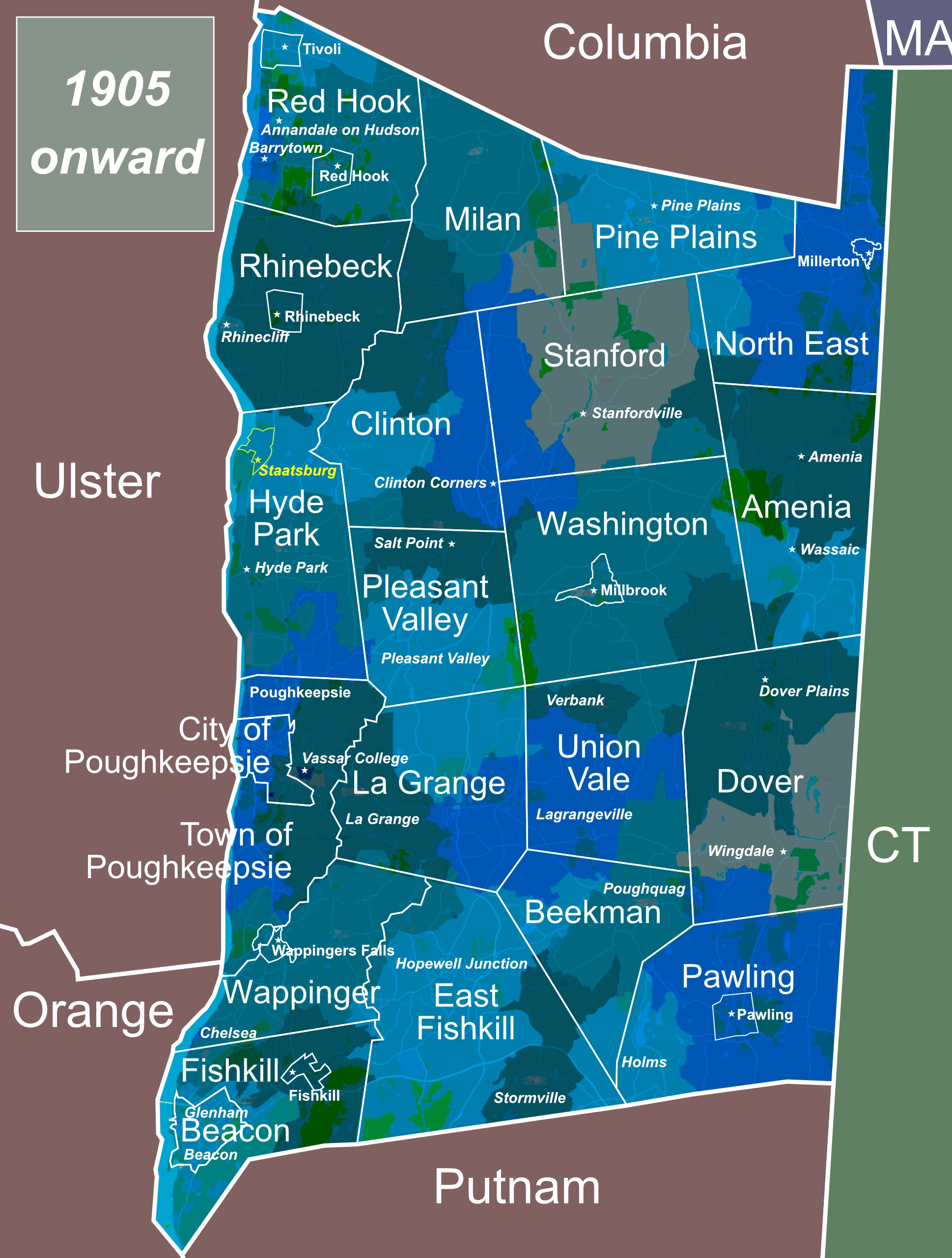
1905 onward – U.S. Post Office Department begins Rural Free Delivery (RFD), with postal inspectors defining delivery routes based on existing roads through farmlands, and other practicalities. The varied color blocks in the 1900’s map, identify the delivery area for each contained post office. Rather than one’s town, the hamlet (or village) location of one’s delivery post office determined the “town” portion of their Mailing Address. (And now 100+ years later, to compound the confusion, that post office-based mailing address is used as the standard geographic addressing for GPS.